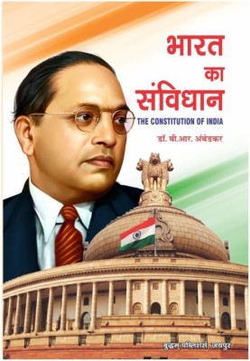
(Pack OF 3 HINDI MAPS) World ( Political, Physical Maps & India Constitution Map)| Set Of 3|Paper Print| Best Useful for UPSC, SSC, IES and other competitive Exams. Paper Print (36 inch X 23 inch, Foldable)
Share
(Pack OF 3 HINDI MAPS) World ( Political, Physical Maps & India Constitution Map)| Set Of 3|Paper Print| Best Useful for UPSC, SSC, IES and other competitive Exams. Paper Print (36 inch X 23 inch, Foldable)
4.2
20 Ratings & 1 ReviewsSpecial price
₹126
₹549
77% off
Available offers
T&C
T&C
T&C
T&C
Warranty
1
Delivery
Check
Enter pincode
Delivery by9 Jul, Wednesday
?
if ordered before 7:59 PM
View Details
Highlights
- Theme: Maps
- Width x Height: 23 inch x 36 inch
- Orientation: Landscape
Services
- 1
- Cash on Delivery available?
Seller
Description
Are you gearing up for your competitive exams? Whether you’re tackling UPSC, SSC, PCS, or Railway exams, we’ve got just the right tool to help you on your journey to success!
Introducing our India Political and Physical Map—a must-have companion for every student and geography enthusiast. This map isn’t just a piece of paper; it’s a comprehensive educational resource crafted with care to enhance your learning experience.
Key Features:
Size: A generous 70x100 cm, perfect for easy visibility and detailed study.
Material: Made from high-quality 80 GSM Maplithon paper, ensuring durability while you explore the diverse landscapes and political boundaries of India.
Printed Quality: Enjoy the best printed quality that showcases vibrant colors and clear details, making it easier to absorb information.
Latest Edition: Stay ahead with the most current map edition, packed with the latest geographical data.
Language: Available in English, making it accessible for a wide range of learners.
QR Code: New this edition, access additional resources through the QR code included on the map!
Why You’ll Love It:
This map is not just about geography; it’s a gateway to understanding India’s rich history and political landscape. Use it for:
Study Sessions: Perfect for exam preparation, allowing you to visualize key locations and their significance.
Combo Learning: Pair it with other maps for a comprehensive understanding of world geography, including the physical layout of different regions.
Visual Aid: An ideal wall hanging that transforms your study space into a vibrant learning environment.
Read More
Specifications
General
| Sales Package |
|
| Color Poster |
|
| Size |
|
| Color |
|
| Art Form Type |
|
| Paper Finish |
|
| Lamination |
|
| Pack of |
|
| Black & White Poster |
|
| Regional Speciality |
|
| Sub Category |
|
| Acid Proof |
|
| Packing Variant |
|
| Painting Style |
|
| Shape |
|
| Style |
|
| Artist Name |
|
| Frame Material |
|
| Other Frame Details |
|
| Other Poster Details |
|
| Net Quantity |
|
Dimensions
| Paper Depth |
|
| Weight |
|
| Other Dimensions |
|
Warranty
| Covered in Warranty |
|
| Warranty Service Type |
|
| Not Covered in Warranty |
|
| Warranty Summary |
|
| International Warranty |
|
| Domestic Warranty |
|
Ratings & Reviews
4.2
★
20 Ratings &
1 Reviews
- 5★
- 4★
- 3★
- 2★
- 1★
- 12
- 4
- 1
- 1
- 2
1
Hated it!
Price is to high
READ MOREFlipkart Customer
Certified Buyer, Kokrajhar District
Nov, 2023
0
0
Report Abuse
Questions and Answers
Q:Laminated or not
A:Non-Laminated
SmartBooksWITHDEVICE
Flipkart Seller0
0
Report Abuse
Didn't get the right answer you were looking for
Safe and Secure Payments.Easy returns.100% Authentic products.
Back to top


