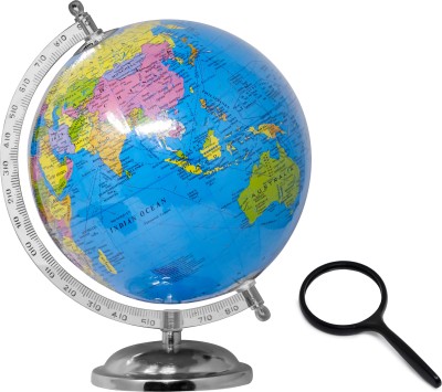
SMALL - 100 WORLD POLITICAL OUTLINE MAP FOR SCHOOL, 2 IN 1 WORLD POLITICAL AND PHYSICAL MAP IN ENGLISH and SCHOOL ATLAS (ENGLISH) - MAPLITHO | Set of 1map pad + 1 map chart + 1 school atlas book | A Comprehensive World Atlas for Students Paper Print (30 inch X 20 inch)
Share
SMALL - 100 WORLD POLITICAL OUTLINE MAP FOR SCHOOL, 2 IN 1 WORLD POLITICAL AND PHYSICAL MAP IN ENGLISH and SCHOOL ATLAS (ENGLISH) - MAPLITHO | Set of 1map pad + 1 map chart + 1 school atlas book | A Comprehensive World Atlas for Students Paper Print (30 inch X 20 inch)
5
3 Ratings & 0 Reviews₹469
₹730
35% off
Available offers
T&C
T&C
T&C
T&C
Delivery
Check
Enter pincode
Delivery by17 Aug, Sunday
?
if ordered before 10:59 AM
View Details
Highlights
- Theme: Children
- Width x Height: 20 inch x 30 inch
Services
- Cash on Delivery available?
Seller
Description
"Introducing Gowoo's combo of SMALL - 100 WORLD POLITICAL OUTLINE MAP FOR SCHOOL, 2 IN 1 WORLD POLITICAL AND PHYSICAL MAP IN ENGLISH and SCHOOL ATLAS (ENGLISH) - MAPLITHO. Small 100-World Political Outline Map is a handy and informative tool designed specifically for school students to understand the political boundaries of different countries worldwide. This map presents a simplified view of the global political landscape,
The map is designed clearly and concisely, making it easy for students to identify and locate countries. The measuring small 100-world political and physical outlines map size is 7*8 inch each on the map pad. The school atlas maplitho paper size is 8.5*11 inch, and the 2in1 political and physical map size is 20*30 inch. This chart and map are perfect for student use. Each country is labelled with its name, allowing students to familiarise themselves with the various nations and their locations. This map also includes significant capital cities, providing additional geographical information.
They can explore the continents, identify neighbouring countries, and learn about the geographical proximity of different nations.
The 2-in-1 World Political and Physical Map combines two essential aspects of geography into a single comprehensive tool. This showcases the world's political divisions and highlights its physical features, such as mountains, rivers, and desertsIt is Is a valuable resource for school students to explore and understand our planet's political and physical aspects.
The political boundaries on this map are demarcated, displaying the names of countries, capital cities, and important regions. They can learn about the continents, countries, and significant cities, fostering a broader understanding of the world's political landscape.
In addition to political information, the map also emphasises the Earth's physical features. Mountain ranges, rivers, lakes, and deserts are highlighted, allowing students to appreciate the diverse topography of our planet. By studying these physical features, students can develop an understanding of how geography influences climate, ecosystems,
The School Atlas, designed in English, is a comprehensive collection of maps and geographical information for school students. This atlas is a reliable guide, providing knowledge about different countries, continents, and regions worldwide.
Each map is carefully labelled, incorporating clear legends, symbols, and scales for easy comprehension.
In addition to maps, the atlas includes informative texts, illustrations, and photographs that enhance the learning experience. Students can explore the atlas to deepen their understanding of various countries' cultures, traditions, and unique features. It encourages a global perspective and helps students develop a broader understanding of the interconnectedness of our world.
These resources—Small 100-World Political Outline Map, 2-in-1 World Political and Physical Map, and School Atlas (English)—are valuable tools that provide simplified and easy-to-understand information, enabling school students to explore and grasp the complexities of global geography."
Read More
Specifications
| Sales Package |
|
| Size |
|
Manufacturing, Packaging and Import Info
Ratings & Reviews
5
★
3 Ratings &
0 Reviews
- 5★
- 4★
- 3★
- 2★
- 1★
- 3
- 0
- 0
- 0
- 0
Have you used this product? Be the first to review!
Be the first to ask about this product
Safe and Secure Payments.Easy returns.100% Authentic products.
Back to top


